Maplat offers the following key capabilities:
- Seamless switching and overlay between non-geodetic map representations—such as historical maps, illustrated maps, and route maps—and accurate modern map coordinates, in real time
- Accurate transformation of orientation and scale, not just center-point coordinates
- One-to-one transformation across the entire coordinate space through a homeomorphic mapping method
(Japanese Patent No. 6684776) - Line-to-line transformation, enabling linear features such as roads and routes to be mapped even when the underlying representations differ in shape
- Open-source availability for both the core library and the data editor
Homeomorphic Transformation (Japanese Patent No. 6684776)
Because Maplat uses a bidirectional one-to-one transformation method (homeomorphic transformation), map displays remain spatially consistent even when switching continuously between different maps.
This proprietary capability distinguishes Maplat from comparable solutions and is protected by patent.
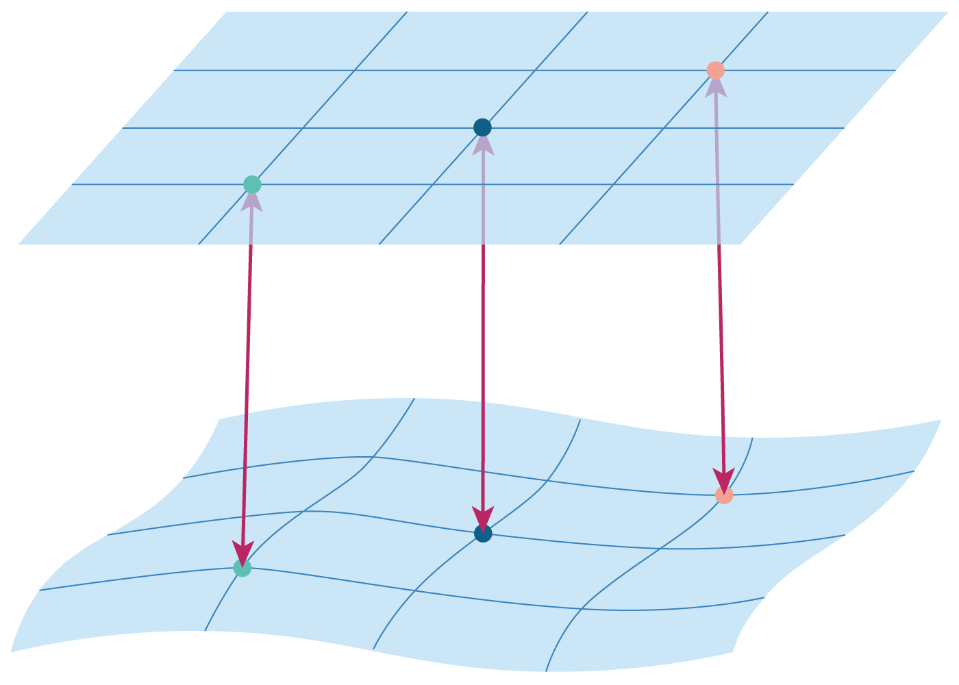
Every coordinate corresponds uniquely on a one-to-one basis, even when the shapes differ.
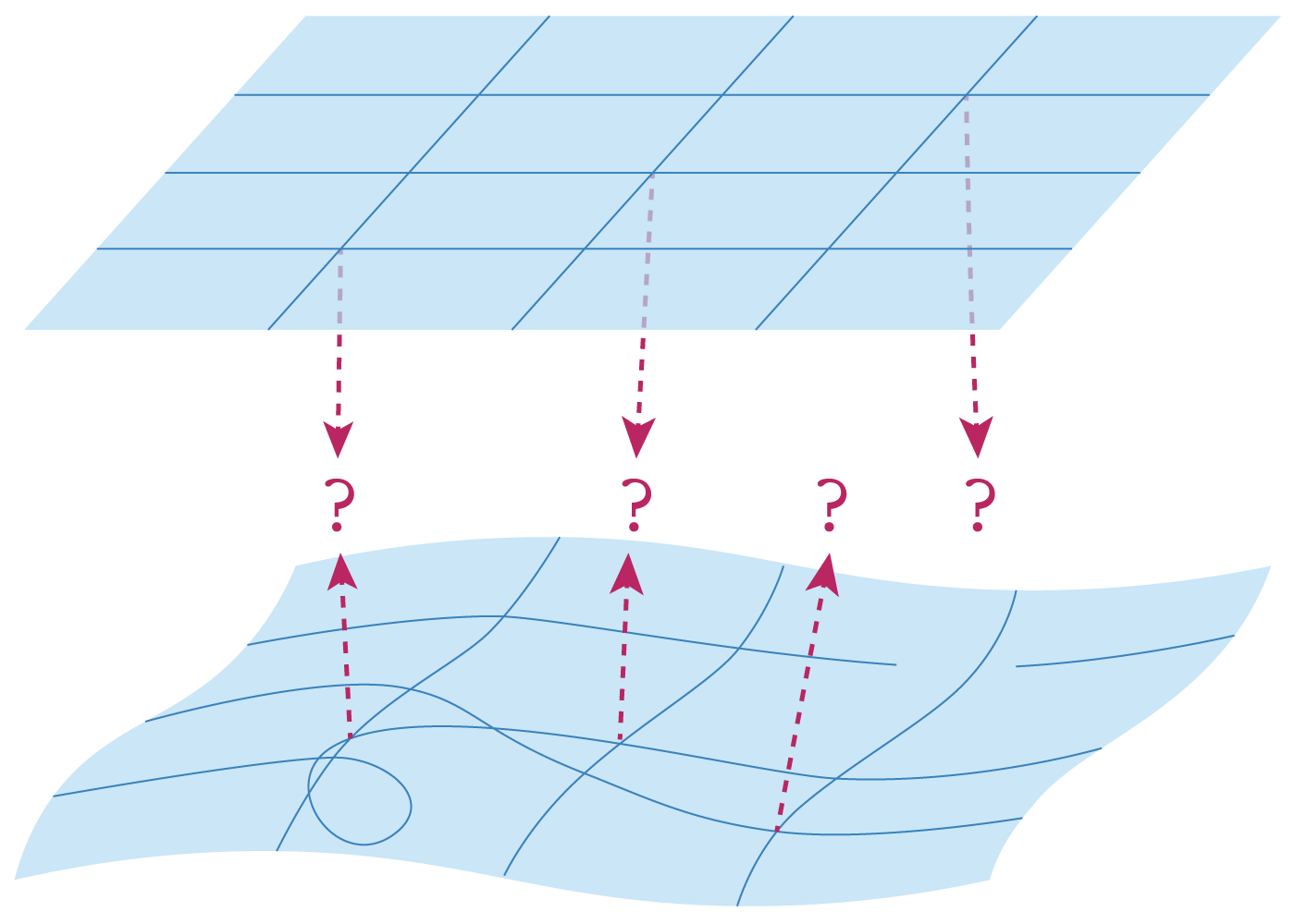
coordinates do not maintain a complete one-to-one correspondence.
Line-to-Line Transformation
Built on its homeomorphic transformation framework, Maplat also guarantees that coordinates located on a line in one representation are transformed onto the corresponding line in another representation.
This capability is particularly effective for schematic maps and diagrammatic representations.

Because line BC on the left corresponds to line BC on the right, points such as P and Q are also guaranteed to remain on the corresponding line.
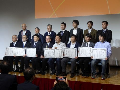
Recognition and Awards
Maplat’s technical excellence has been recognized through multiple awards and selections.
- 2018 — Achieved the first and only triple award in the history of the Geo Activity Contest, organized by the Geospatial Information Authority of Japan, Ministry of Land, Infrastructure, Transport and Tourism
(Grand Prize, Education Impact Award, and Visitors’ Choice Award) - 2019 — Passed the first-round screening in the Disruptive Challenge Category of InnoVation, organized by the Ministry of Internal Affairs and Communications
- 2021 — Received the Encouragement Award at the Geo Activity Contest, organized by the Geospatial Information Authority of Japan, Ministry of Land, Infrastructure, Transport and Tourism