Maplat can be used to compare local historical maps or early Showa-era aerial photographs with the present-day townscape. It can also be used to display hazard maps processed with Maplat on a smartphone—something people can keep close at hand in an emergency—so that they can check their current location, evacuation sites, and other important information.
Experts in historical maps often point out that older maps can reveal areas prone to disaster risk in ways that are not apparent from today’s roads and rivers alone. While disasters cannot be prevented entirely, we hope Maplat can help reduce their impact by making such information more accessible and easier to understand.

Also Useful for Primary Education and Intergenerational Learning
In elementary school, students learn about the municipalities and prefectures in which they live. To support this, local boards of education often prepare supplementary learning materials designed to be easy for children to understand. Illustrated maps included in these materials can be incorporated into Maplat, allowing students to explore the actual town while connecting what they see on the map with the real world.
Maplat can also support intergenerational communication. By comparing old maps or aerial photographs with current maps together with senior residents, it may spark conversations such as, “This road used to run differently,” or “That river once curved here, but was later straightened through construction.” In this way, Maplat can become a tool not only for learning, but also for passing down local memory and lived experience.
Examples
Higashinari Town Walk Map (no longer available)
Higashinari Ward, Osaka City
http://higashinari-walk.fun/
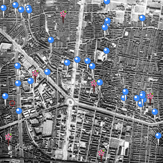
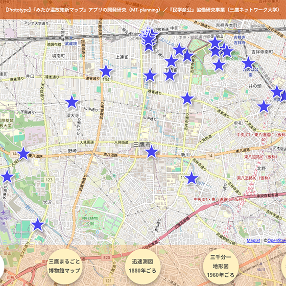
Mitaka Past and Present Map
Mitaka City, Tokyo (Collaborative research project among citizens, academia, industry, and government / Mitaka Network University)
https://onkochishinmap.com/mitaka/